
 800-4-SEATOW
 Service Locator


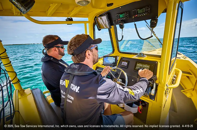
AIS, or Automatic Identification System, is marine navigation technology that allows boats to broadcast and receive vessel information such as name, location, speed, course, and heading. AIS helps boaters see nearby vessel traffic, understand what other boats are doing, and reduce collision risk, especially in busy waterways, low visibility, or nighttime conditions.
AIS does not replace radar, navigation lights, charts, or a proper lookout. Instead, it works alongside other navigation tools to improve situational awareness on the water.
What Is AIS on a Boat?
Automatic Identification System (AIS) is a digital “name tag” every large commercial vessel must broadcast. It rides on the same VHF band as your marine radio and sends two kinds of information:
- Dynamic Data: changes every few seconds (GPS position, speed, course, heading).
- Static Data: this information includes the vessel name, MMSI number, size, and destination and rarely changes. Ships exchange this data directly, ship‑to‑ship and ship‑to‑shore, 24 hours a day.
The International Maritime Organization wrote AIS into the SOLAS (Safety of Life at Sea) Convention, making it mandatory on passenger ships of any size and on most cargo ships above 300 gross tons by the end of 2004.
What Does AIS Help Boaters See?
AIS turns vessel broadcasts into useful traffic information. Depending on the equipment in use and the data being transmitted, AIS can help boaters identify:
- Nearby commercial vessels
- Recreational boats equipped with AIS
- Vessel name and MMSI number
- Speed and direction of travel
- Closest point of approach
- Navigation status
- AIS aids to navigation
- Man-overboard or AIS beacon alerts, when applicable
AIS only displays vessels or devices that are transmitting or otherwise represented through AIS. It will not show every boat, floating object, shoreline feature, or navigation hazard.
Why AIS Matters for Recreational Boaters
Even if you never leave the inlet, AIS shrinks the blind spots left by radar and human vision.
- Prevents collisions by showing target names, CPA (closest‑point‑of‑approach) alerts, and speed vectors in real time.
- Speeds up rescues. Coast Guard watch‑standers can see your last broadcast even if they never catch your Mayday.
- Reduces stress. You know what the ferry up ahead is doing and she knows you’re there too.
How AIS Works on Boats
Two tiny VHF channels do the heavy lifting
AIS uses Channel 87B (161.975 MHz) and Channel 88B (162.025 MHz). Every transceiver grabs a micro‑slice of time – one of 2,250 slots per minute – then transmits its message using 9,600 bps Gaussian Minimum Shift Keying (GMSK). Because the slots reshuffle (Time Division Multiple Access), hundreds of boats can talk at once without stepping on each other.
What gets sent
Your GPS feed tells the AIS where you are as onboard sensors add course, heading, and rate of turn; whereas the captain programs static facts once per voyage. The transceiver packages everything into a 168‑bit telegram and fires it out every 2–10 seconds underway for Class A – big ships, or every 30–180 seconds for Class B – recreational & light commercial. Shore stations and satellites scoop up the same messages.
Class A vs. Class B AIS
AIS equipment generally falls into two main classes:
| Feature | Class A (Big Ships) | Class B (Recreational & Light Commercial) |
| Required by law? | Yes, per SOLAS V/19 | No (U.S. rules mandate it only for certain commercial categories) |
| Power output | 12.5 W | 2 W (Class B CS) / 5 W (Class B SO) |
| Update rate | 2–10 s while moving | 30–180 s while moving |
| Sensors | GPS, heading, rate‑of‑turn | GPS only (heading optional) |
| Typical cost | $$$ | $ |
Class B transponders are the faster‑growing segment because they give small‑boat captains the same situational awareness that commercial ships enjoy – without the big‑ship price tag.
Other Types of AIS Devices
- AIS Aids to Navigation (AtoN). Buoys and lights broadcast their own position – or appear virtually on your chart plotter.
- AIS SART & MOB beacons. A man‑overboard device screams your GPS fix to every AIS target within ~10 nm.
- Satellite AIS (S‑AIS). Low‑Earth‑orbit satellites extend reception thousands of miles offshore, feeding Coast Guards, insurers, and shipping analysts.
What Information Does AIS Broadcast?
| Dynamic | Position (lat/long to 0.0001’), Speed over Ground (0.1 kn resolution), Course over Ground, True heading, Rate‑of‑turn, Navigational status | Seconds (Class A) or minutes (Class B) |
| Static/Voyage | MMSI, vessel name & call sign, IMO number, ship type, dimensions, draft, destination, ETA | Every 6 minutes |
How Far Does AIS Work?
Terrestrial range is basically “radio line‑of‑sight.” From a sailboat mast you’ll see about 20 nautical miles; from a 150‑foot bridge wing the horizon stretches 40 nm or more. Satellites pick up the same 12.5‑watt whispers from 400 km overhead, but in dense lanes signals can collide, reducing hit‑rate.
AIS Limitations and Safety Considerations
AIS messages are not encrypted. Attackers can spoof, jam, or impersonate ships. However, countermeasures include:
- Plausibility filters that flag jumps in speed, course, or MMSI.
- Direction‑finding antennas that compare bearing angles.
- Experimental digital signatures now under review at the ITU and IEC.
Until encryption becomes standard, the best defense is layered sensors, radar, visual watch, and common sense.
The Future – VDES & Smarter Analytics
The VHF Data Exchange System (VDES) is the next‑gen upgrade. By adding new channels and burst data rates up to 307 kbps, VDES will carry software updates, weather files and even two‑way text without hijacking AIS safety slots. Machine‑learning models already crunch AIS tracks to forecast arrival times or spot illegal fishing; OECD and Global Fishing Watch dashboards make the insights public.
AIS Is Not a Substitute for Safe Navigation
AIS should be treated as one layer of navigation awareness, not a replacement for safe boating practices. Continue to use up-to-date charts, a GPS or chartplotter, radar when equipped, navigation lights, sound signals, and a proper visual and audible lookout.
Not every vessel transmits AIS, and the information shown can be incomplete, delayed, or incorrect. If AIS information conflicts with what you see or with another navigation tool, slow down, verify the situation with multiple sources, and use safe boating judgment before changing course.
Installing AIS on a Recreational Boat
Pick the right unit
Match the transceiver to your use case. Weekend coastal cruisers usually choose Class B SO (5 W, faster update). Offshore racers may spring for Class A to get turn‑rate data.
Mount the antenna high
AIS shares your VHF antenna or uses a dedicated whip. Height, not wattage, is king for range, so aim for the spreaders or radar arch.
Feed it GPS
Most black boxes include an internal GPS, but a dedicated antenna clears deck clutter and avoids metal shadowing.
Wire into your network
NMEA 2000 makes plug‑and‑play easy: one “T” drop to your backbone and every chart plotter, MFD, or tablet glimpses the same targets.
Program the static data
Enter your MMSI, boat length, call sign, and a default destination. Double check your information because the Coast Guard issues fines for bogus entries.
Test and sail
Power up, ask a buddy 5 miles away to confirm they see your MMSI, and that you’re broadcasting.
FAQs
Do recreational boats need AIS?
Most recreational boats in the United States are not required to carry AIS, although certain commercial and passenger vessels are subject to AIS carriage requirements. Recreational boaters can choose to install AIS to improve awareness of nearby vessel traffic.
Does AIS show every boat?
No. AIS only shows vessels and devices that are transmitting AIS information or are represented by an AIS aid to navigation. Smaller recreational boats may not carry AIS, so boaters still need to maintain a proper lookout and use other navigation tools.
Is AIS the same as GPS?
No. GPS determines a vessel’s position. AIS uses position data, typically from GPS, together with information such as vessel name, MMSI, speed, course, and heading so that compatible AIS equipment can broadcast and receive vessel information.
Can AIS help prevent collisions?
AIS can help reduce the risk of collision by showing nearby AIS-equipped vessels, their direction of travel, speed, and closest point of approach. It does not prevent collisions by itself and should always be used together with a proper lookout, navigation rules, charts, radar when equipped, and safe boating judgment.

Sea Tow Team
Sea Tow has been the premier leader in on-water boating assistance since 1983. We want to share news, press, tips and all things boating.
Updated on: - Created on: